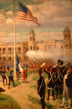
Louisiana Purchase
- On April 30, 1803 the nation of France sold 828,000 square miles (2,144,510 square km)
- of land west of the Mississippi River to the young United States of America in a treaty commonly known as the Louisiana Purchase
- More than doubled the size of the United States at a time when the young nation's population growth was beginning to quicken
- The Louisiana Purchase was an incredible deal for the United States, the final cost totaling less than five cents per acre at $15 million (about $283 million in today's dollars)
- France's land was mainly unexplored wilderness, and so the fertile soils and other valuable natural resources we know are present today might not have been factored in the relatively low cost at the time
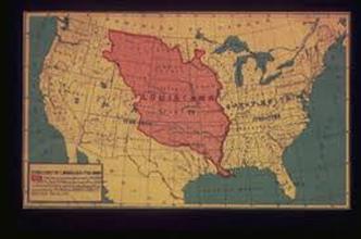
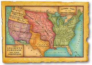
- The Louisiana Purchase stretched from the Mississippi River to the beginning of the Rocky Mountains
- Official boundaries were not determined, except that the eastern border ran from the source of the Mississippi River north to the 31 degrees north
- Present states that were included in part or whole of the Louisiana Purchase were: Arkansas, Colorado, Iowa, Kansas, Minnesota, Missouri, Montana, Nebraska, New Mexico, North Dakota, Oklahoma, South Dakota, Texas, and Wyoming
The Louisiana purchase began on April 30 1803. In the nation of France, sold by the price of 828,000 square miles and (2,144,510 square km.) As the United States spread across the Appalachians, the Mississippi River became increasingly important for the America’s West . Since 1762 the Spain had owned Louisiana, which included 828,000 miles. And now it makes part of fifteen separate states between the Mississippi River and the Rocky Mountains.